


Erosional Features of a Worldwide Flood
As newly formed mountain ranges and continental landmasses appeared from the floodwaters, eroded and suspended sediments of the receding waters formed vast alluvial plains that today extend from the Rocky Mountains to the Mississippi, and from Canada to Mexico, and throughout most of the world. Erosional remnants of the receding waters include great monoliths (monadnocks) surrounded by peneplains, low flat featureless plains found throughout the world. Other erosional remnants include landforms such as plateaus, mesas, buttes, spires, pinnacles, balanced rocks, arches, dry falls and canyons, ancient drainage lakes, deeply incised meanders, and underfit rivers and overfit valleys.
There is a preponderance of evidence that such features were the result of rapid erosion while underwater, not erosion over millions of years while the land was exposed to dry conditions. Most secular geologists reject massive catastrophic processes because they imply Divine creation and a young earth.
 |
 |
|
| Ayers Rock, Australia, is also known by its Aboriginal name, “Uluru.” Great Sandstone Monolith surrounded by flat, featureless peneplains. Released into the public domain. |
Red Butte, SR 180, Arizona Photo by Roger Gallop |
 |
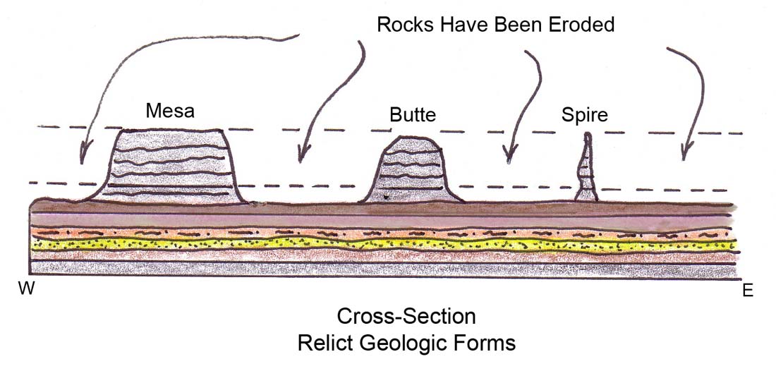 |
| Sketches by Roger Gallop | |
 |
| Grand Canyon, Arizona Photo by Roger Gallop |
 |
| Goosenecks Photo by Roger Gallop |
Goosenecks State Park is located about 40 miles south of Natural Bridges National Monument near Mexican Hat, Utah. The "goosenecks" refer to several narrow land bridges formed between entrenched stream meanders along the San Juan River. The rocks exposed in the gorge at the goosenecks are fossiliferous limestone and shale.
 |
 |
 |
| Bryce Canyon, UT | ||
| Photos by Roger Gallop | ||
 |
 |
| Balanced Rocks, SR 89A, AZ Photo by Roger Gallop |
Dry Falls, eastern Washington’s Lower Grand Coulee, is believed to have been the world’s largest waterfall. Courtesy of the U.S. Geological Survey, an agency of the U.S. Department of Interior. |


 ShareThis